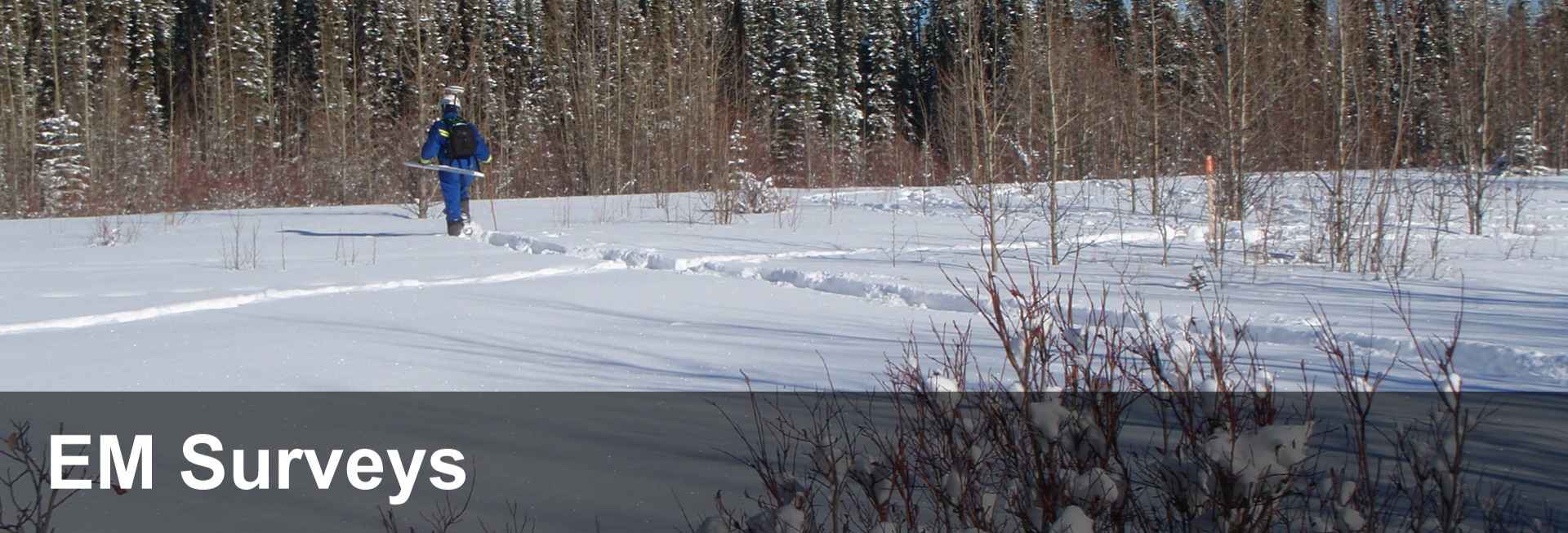
PENSERV EM System
EM surveys are conducted using a GEM 2 with a GPS to streamline data collection and reduction. The EM equipment and GPS antenna can be carried manually in fields with crops, forested areas and congested industrial sites or mounted on a fiberglass sled and towed by an ATV across open sites at speeds of 4 – 6 m/sec (14 – 19 km/hr). EM data is collected at about 4 readings per second, resulting in about 1 – 1.5 m between EM readings. The GPS antenna receives real time corrected (RTCM) satellite signals that determine the position of the instruments on the face of the earth with an accuracy of about ± 60 cm in real time. The surveys are generally run in parallel lines, at nominal 5 m line spacing over the site. To give you an idea of what our soil salinity mapping system looks like, click on the play button of the video to see an EM survey in action.
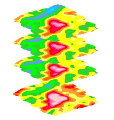
Multi-Frequency EM Surveys
EM surveys can be used to delineate and quantify the extent of bulk soil conductivity impacts both on site and off site. The severity of the impact of soil conductivity or salinity can be estimated by relating the EM map colour scale values to laboratory derived electrical conductivity (EC) readings and their effects on soils and plants. PENSERV currently uses the Geophex Gem2 EM sensor capable of collecting data from multiple frequencies simultaneously up to 30 times per second over a range of 95 KHz to 300 Hz corresponding to an approximate depth range of 0.5 to 30m. PENSERV typically uses 4 depth ranges from 0.5 to 5 m.
Real Time Global Positioning Systems (GPS)
The biggest advantage of GPS is the reduction of time and labor required to map the site. More surveys can be run in a working day. Real time GPS means less data processing is required and facilitates the preparation of maps in the field. GPS is ideal for recording sampling locations which may be accessed repeatedly over time. PENSERV uses the satellite based augmentation system (SBAS, formerly WAAS) for real time differential correction that is built in to the Hemisphere GPS receivers to provide submetre accuracy for its EM surveys.
In addition, with every survey, PENSERV includes a geo-referenced pdf file that can be used in the Avenza Pdf Maps app that can be installed onto your iPhone or Android phone. Sampling points can be picked from the pdf maps while you are on site and the coordinates can be recorded and emailed back to your office.